Gills spur-road retaining wall restoration
7th July 2013
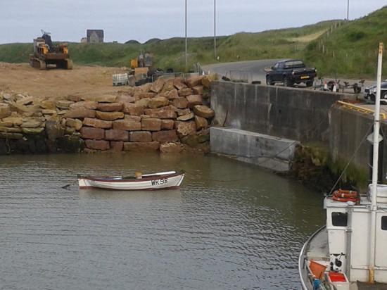
Staff with a Caithness civil engineering firm, working on behalf of the Highland Council, have been taking advantage of a recent astronomical phenomenon to secure the future integrity of a key access road in the Far North.
A small section of the foundations of the Council's 'spur' access road from the John O'Groats to Thurso A 836 route to busy Gills Harbour were undermined by the action of a 'very severe' sea-storm last winter.
In late June 2013, astronomers correctly predicted that the Moon would be closest to the Earth in 2013 at less than 222,000 miles away ... and the resulting increase in its gravity 'pull' could lead to noticeably higher and lower tides, with the latter ebbing down to near Lowest Astronomical Tides (LAT) levels. This is known as a 'lunar perigee', or as a 'super-moon' by 'fortune-telling' astrologers.
Part of the foundation of the Gills Harbour 6-metre wide access route, constructed for the Regional Council in 1989, became eroded during the severe Atlantic-origin Westerly storm of February 4th and 5th this year.
Record-breaking swell-heights were captured during that Atlantic storm, when gales reached hurricane force due to an extreme low-atmospheric pressure 'low' which swept over the North of Scotland.
The readings were from modern 'measuring devices' at the European Marine Energy Centre's experimental wave-power site near Stromness, Orkney and at several automatic wave-monitoring 'stations' in the North Atlantic near the North and West coasts of Scotland. Those included readings at offshore Metrological Office buoys of waves in excess of 20 metres (65 feet) in height.
Gills Harbour was unaffected by the severe North Sea storms of late 2012, which damaged East Coasts ports the length of Scotland, but the Westerly storms of February 4th were the severest experienced there for at least a decade.
The remedial measures at Gills were conducted for the Council 'sTEC Services (roads) section by local civil engineering and quarry contractors A & W Sinclair, of John O'Groats, with the very low tides allowing its employees to gain access with relative ease to the foundation-base of the roadway immediately to the West of the final approach bend.
Any year's maximum tidal range of c. 4 metres at Gills is usually seen in the spring (locally known as 'stream') tides nearest to the March or September equinoxes, rather than near mid-summer's day. A high atmospheric pressure area lay over the North of Scotland in late June, leading to an extra downwards pressure on the sea-surface and thus lower ebb-tides.
Those allowed the Caithness firm's staff to firmly fix a steel shutter to allow concrete to be poured and 'moulded into' the eroded 'hole', beneath the road's carriageway.
The spur road to Gills Harbour, which carries much of the heavy Orkney-bound traffic to Pentland Ferries ROPAX terminal there, is also expected to carry significant 'renewable energy' loads, although much of the heavier 'kit' may be sailed to Gills by cargo-ship or barge.
The 1989 access roadway, which replaced a single-track mainly un-surfaced predecessor, represents the only significant public-sector investment (c. �200,000) so far made at Gills, where all other works to date have been undertaken by its local community owners Gills Harbour Ltd and its lessee Pentland Ferries.
The latter company is also active at Gills this summer with civil engineering works to enhance sea-safety, by providing a 100 metre X 100 metre 'turning circle' to allow its modern catamaran ship Pentalina to access and leave Gills Harbour in forward motion in almost all weather states in the lee of its present 116 metre-long breakwater/berth and its planned 70 metre extension.
Both piers are recycled former World War II floating dry-docks, using dredged bed-rock spoil as ballast to minimise the effect on any natural wild-life in Gills Bay and added internal and external strengthening.
The terms of Pentland Ferries' consent for the works from Scottish Government agency Marine Scotland, means that the planned breakwater extension will be offset from the seaward end of the present one. This will permit 'tidal stream' renewables vessels to be berthed alongside without affecting scheduled ferry movements on the 15-mile-long 'short sea route' to St Margaret's Hope, on Orkney's main roads network.
During the month of May, most of Orkney's 'lifeline' traffic on HGV articulated trucks flowed though Gills Harbour on the unsubsidised Pentland Ferries operation. It provided the islanders with an 'essential service' when the rival Hamnavoe had to be taken off her Scrabster to Stromness route to allow a broken main engine crankshaft to be replaced at the Babcock International-operated dockyard at Rosyth, near Dunfermline, Fife.
Serco NorthLink Ferries Ltd's 28-mile long trans-Pentland seaway is bolstered by a taxpayers' subvention of over �10 million pounds per annum on its passengers, (over �100:00 per person), but the key freight is carried across the Firth by both firms 'on a commercial basis',.
In the case of Gills, this is by 'arctic' trucks driven over the spur-road access to the harbour's ferry 'link-span', the hydraulically-operated 'shore to ship' bridge.
Pentland Ferries Ltd's passengers are also carried without any Government support. Its entrepreneurial managing director Andrew Banks has fixed the return fare at �28:00 return on a year-round basis for all of 2013, lower than the rate on the subsidised Scrabster to Stromness seaway.
Related Businesses
Related Articles
Three Cats At Gills Harbour
Two catamaran work-boats berthed at Gills Harbour this week with the trans-Pentlnd ferry MV Alfred, also a catamaran, in the background. The larger workboat is MPC Athenia which was being used as a floating base or ROVs - remote underwater vessels, for detailed inspections on the three turbines operating at the MeyGen demonstration subsea site one and a half miles off Gills Harbour.
GILLS HARBOUR Ltd ANNUAL GENERAL MEETING
GILLS HARBOUR Ltd - ANNUAL GENERAL MEETING at JOHN O'GROATS VILLAGE HALL, MONDAY JUNE 13th @ 7.30 PM. GILLS HARBOUR IS THE ONLY OFFICIALLY-RECOGNISED 'ECONOMIC DEVELOPMENT AREA' IN NE CAITHNESS.Latest Boats At Gills Harbour For Work At Meygen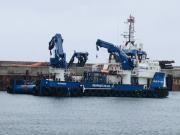
£10 million 'Isle of Jura' temporarily based at Gills Harbour in Far North of Scotland for her crew's debut tasks in the tidal-stream electricity field at the MeyGen sub-sea site, one mile off the little Caithness's port entrance channel. One of the UK's most modern marine renewables service vessels made her debut calls at community-owned Gills Harbour, near John O'Groats, over the 2021 Spring Equinoctial weekend.
Busy Gills Harbour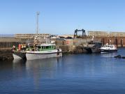
Its been a busy few days at local community-owned Gills Harbour ..... sometimes in suberb sunny weather as here ...
Energy Developments Continue at Gills Harbour and the Pentland Firth
The company behind the world-leading tidal-stream prototype power plant in the Pentland Firth's Inner Sound is set to start manufacturing a new-style turbine that is hopes will reduce the project's generating costs. Simec Atlantis Energy (SAE) and a privately-owned specialist engineering firm from Spain's Bay of Biscay coastline have jointly been conducting 'research and development' (R& D) on the project for almost a year and are now ready to give it the go-ahead.
New Generation of office-bearers set to step up at Gills Harbour Ltd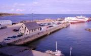
A new generation of younger local folk look set to take over the reins of running Gills Harbour Ltd, the local company that owns and operates the busy little port on the shores of the Pentland Firth's Inner Sound that holds its AGM this Saturday (10.10.20) morning at 10:00 am. The influx of younger blood comes after two key directors of the group that had run 'Canisbay's Peoples Port' both announced their retirement from office, whilst another Gills Harbour Ltd (GHL) office-bearer has declined to seek re-election.
MV Alfred And MV Pentalina Together At Gills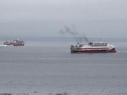
An 'old friend' returns to Gills Bay after an absence of manymonths. The 2,400 tonne 70 m.
Normand Cutter, The Norwegian-owned Offshore Construction Vessel at Gills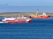
Here is the Normand Cutter, the Norwegian-owned offshore construction vessel that has been the base for works on Simec Atlantis Energy's (SAE's) MeyGen site in the Pentland Firth's Inner Sound, off Gills Bay during the current neap-tide sequence, that has lasted most of the week commencing 11.08.20. Picture by retired C of S Kirk Minister the Rev Lyall Rennie, who lives at Lower Warse, Canisbay, on the shores of Gills Bay..
New Ferry For Pentland Ferries Arrives Safely
Scotland's most modern + environmentally-friendly, fuel-efficient ROPAX ferry ship rge MV Alfred, arrived AM today (Wed 09.10.19 at St Margarets Hope. The boat went round to Kirkwall immediately at the end of 9,000+ miles voyage from the Strategic Marine yard near Ho Chi Minh city (ex.
Gills Harbour Ltd Awards Contract To Local Firm
Gills Harbour Ltd, the community-owned body that owns & operates the busy little port on Caithness's North Coast, has awarded a remedial contract to a Wick-based company. The deal, won in a competitive tender, has gone to builders/civil engineers Messrs GMR Henderson Ltd, of Martha Terrace in Wick.
