Truths Is A UK-led Mission To Create A Space-based Climate And Calibration Observatory
17th September 2024
TRUTHS is a UK-led mission to create a space-based climate and calibration observatory that will improve confidence in climate change forecasts and support net zero mitigation strategies and their impact.
The Traceable Radiometry Underpinning Terrestrial- and Helio-Studies (TRUTHS) mission, delivered by ESA, will collect the most accurate measurements of energy coming into the Earth from the Sun, and light reflected off Earth's surface, to help understand changes in balance (global warming) and humanity's impact on the planet.
The mission will not only make measurements itself, but also improve the performance of other missions through calibration from space, becoming a new ‘gold standard' reference for climate measurements and other satellites including the ‘new space’ commercial satellites. TRUTHS will allow rigorous testing of model forecasts to support decision-making on climate strategies. The mission will enable a 10-fold improvement in accuracy of data, which will, in turn, halve the time required for making decisions and also help monitor the progress of mitigation.
As the first of a new class of satellites called SITSats (SI Traceable Satellites) TRUTHS will help facilitate a new epoch in Earth observation. Enabling an integrated, interoperable global space-based observing system to deliver trustworthy harmonised data from all the worlds satellites to meet the needs of society. Together with other national EO data infrastructure projects a world first capability.
Key facts
The TRUTHS mission started development in spring 2020 with a launch date planned for 2030 followed by operations for a further 5 to 8 years.
The mission’s hyperspectral imaging spectrometer will deliver around 5TB of data per day.
TRUTHS is an agile platform that points to observe the Sun and Moon as it passes over the poles and then continually samples the sun-lit Earth with a spatial resolution of 50m and spectrally resolved from the ultraviolet to infrared to allow detailed analysis of the Earth’s processes.
TRUTHS flies in a novel orbit which allows it to simultaneously view the same scene as other satellites regularly, which enables increased confidence in data and derived information from other EO satellites through in-flight reference cross-calibration.
Alongside involvement from a range of UK organisations, the programme is being implemented by ESA with funding from Switzerland, the Czech Republic, Romania, Greece and Spain.
How is the UK involved?
As part of a contract awarded by ESA, Airbus UK now lead the implementation phase of the mission following a successful conclusion to an earlier ‘system feasibility and predevelopment’ phase which concluded in 2022.
The National Physical Laboratory (NPL) is providing support to the design of the mission as part of the industrial consortium, particularly related to the on-board and pre-flight calibration and characterisation concepts. The team is also providing the algorithms to assess and characterise the uncertainty of the mission’s data products.
In a separate contract, NPL leads UK and European scientists in the underpinning science studies and associated algorithm developments that will be needed to exploit the mission data following launch. This science team are also providing engineering and scientific support to ESA and the industrial consortium to optimise trade-offs in the planned operations and payload design to ensure maximal performance and benefit to the UK and international community as a whole.
Teledyne e2v Space Imaging have been contracted to supply the TRUTHS hyperspectral sensor, and for the full design, manufacture and Technology Readiness Level (TRL) raising activities of the associated front-end electronics. These are the critical technologies of the Hyperspectral Imaging Spectrometer (HIS) which will acquire Earth, Sun and Moon radiation measurements across the whole spectral range, from ultraviolet to infrared.
CGI IT UK has undertaken a subcontract with Airbus UK to develop the preliminary definition of the Payload Data Ground System that will be responsible for:
exploitation of the instrument data.
facilities responsible for mission planning and control
quality control including calibration, validation and monitoring
instrument performance assessment vital to delivering reliable data to scientists and the precise orbit determination.
user services interface and acquisition, processing and archiving
Telespazio UK’s role in the project is to support the Ground Segment study team in defining the requirements and necessary architecture for the mission. In particular, the Telespazio UK team is responsible for the Flight Operations Segment, encompassing the Mission Control System and Telemetry, Tracking and Control.
(TT&C) Ground Stations, tasked with monitoring and controlling the satellite, flight dynamics, mission planning and mission operations simulation functions.
Further studies on how the ground segment might function have also been carried out by GMV UK and these and others are now in the process of forming consortia to build and prepare to implement the ground segment as the mission progresses to launch.
As part of a consortium, led by Airbus, who delivered the project’s system feasibility and predevelopment phase, Goonhilly Satellite Earth Station delivered a study on skills, capability development, and outreach in the context of the mission. This activity is seen as highly valuable to the UK space sector as a whole. The critical importance of space and Earth observation to the UK economy will need the inspiration and enthusiasm of the next generation to ensure UK meets its ambitions.
RAL space are preparing to deliver P/L (Payload) and Satellite AIT (Assembly, Integration and Testing) and calibration, utilising vacuum and clean room facilities at RAL and state of the art radiometric calibration facilities provided by NPL. They are also involved in the development of algorithms to support geometric and image quality and associated uncertainty for the image processing as part of the ground segment.
AVS-UK have recently joined the industrial consortium to design and build elements of the novel on-board calibration system. Whilst SSTL are engaged in the design and prototyping of the hyperspectral imaging spectrometer, the workhorse of the mission.
As the mission design progresses, simulators (digital twins) of the functionality of the payload to support its design, assess its performance and serve as prototypes for the ground processor are required. The processor will transform the digital counts transmitted from the satellite’s instruments to ground into scientifically useable data products and information. Deimos UK leads a consortium to develop these as part of a sub-contract to Airbus, the industrial prime.
NCEO through the University of Leicester together with UCL, Swansea and Imperial College London are providing studies and support to the science preparation and optimisation of the mission, including the development of the algorithm to retrieve hyperspectral surface reflectance values with uncertainties, the utility of the data to support understanding of radiation imbalance and a range of parameters associated with monitoring and mitigating the impact of climate change. The science studies form part of a separate independent contract to that led by ADS, in this case it is led by NPL.
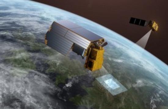
PHOTO
New design of TRUTHS
ESA and Airbus