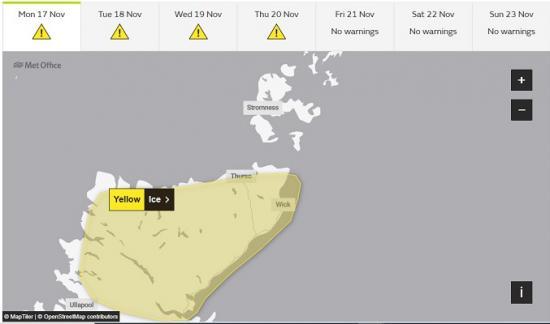
Met Office Weather Warning - Tueday to Thursday
18th November 2025
Frequent snow showers from late Tuesday through Wednesday and Thursday. This may lead to some disruption.
What should I expect?
Possible travel delays on roads stranding some vehicles and passengers
Untreated pavements and cycle paths might be impassable
A chance of injuries from slips and falls on icy surfaces
Power cuts may occur and other services, such as mobile phone coverage, may be affected
Some rural communities could become cut off
Bus and train services may be delayed or cancelled, with some road closures and longer journey times possible
What should I do?
5 tips for staying safe in snow
4 tips for staying safe in ice
Prepare a winter kit for your car
Further detail
Snow showers will feed inland on brisk northerly winds from late Tuesday through Wednesday and into Thursday, giving significant accumulations in places. Whilst there will be a lot of regional variation in amounts, where showers are most frequent 2-5 cm will be possible at low levels, with 5-10 cm on hills above about 100 m elevation, and potentially as much as 15-20 cm above 300 m.
Gusty winds and perhaps a few lightning strikes may accompany some of the showers, posing as additional hazards. Where showers persist and/or snow partially thaws and then refreezes overnight, this will bring a risk of ice.
What Should I Do?
Snowy, wintry weather can cause delays and make driving conditions dangerous, so to keep yourself and others safe: plan your route, checking for delays and road closures, amending your travel plans if necessary; if driving, leave more time to prepare and check your car before setting off; make sure you have essentials packed in your car in the event of any delays (warm clothing, food, water, a blanket, a torch, ice scraper/de-icer, a warning triangle, high visibility vest and an in-car phone charger).
Keep yourself and your family safe when it is icy. Plan to leave the house at least five minutes earlier than normal to reduce your risk of accidents, slips, and falls. If making a journey on foot, try to use pavements along main roads which are likely to be less slippery. Similarly, if cycling, try and stick to main roads which are more likely to have been treated.
People cope better when they have prepared in advance for the risk of power cuts or being cut off from services and amenities due to the snow. It's easy to do; consider gathering torches and batteries, a mobile phone power pack and other essential items.
Be prepared for weather warnings to change quickly: when a weather warning is issued, the Met Office recommends staying up to date with the weather forecast in your area.
Check your area at metoffice.gov.uk