43,000 Breakdowns Expected As Ice and Snow Descends On The UK
22nd January 2019
No Snow in Caithness today but read on - -
As the Met Office issues a nationwide alert for icy conditions and wintry showers over the next twenty four hours, breakdown cover provider Green Flag predicts 43,000 incidents, including 11,481 battery-related issues on UK roads over Tuesday 22nd and Wednesday 23rd January 2019.
Forecasters are predicting showers bringing rain, hail sleet or snow showers on Tuesday evening, followed by a widespread frost with icy patches across much of the country that will continue into Wednesday. There is also a chance this weather could develop into thundersnow, which, when combined with icy conditions, is set to cause dangerous driving conditions.
Simon Henrick, Head of News at Green Flag, commented: "Ice on roads and surfaces makes for a risky commute, so we urge drivers to do all they can to stay safe when taking to the roads.
"What's more, the risk of snow showers or thundersnow means drivers may be caught by surprise if they find themselves in adverse conditions, so it's worth keeping an eye on weather forecasts for your region and only drive if absolutely necessary."
Green Flag has issued further easy, common sense tips and winter weather driving tips, to keep in mind ahead of a journey over the next twenty four hours:
Walk around the car and look for any signs of potential trouble, especially tyres and lights.
Check tyre pressures, spare included.
Check all fluid levels and top up if necessary.
Make sure you have breakdown cover.
Keep a road map in the car so you'll be able to explain where you are when you call for help. Don't rely on the map on your phone - you won't always have signal.
Make sure your phone battery is topped up - think about buying an in-car charger just in case you need it.
Have the number for your emergency breakdown provider handy - you'll usually find it on your policy certificate so you could keep this in the glove box.
Carry a red warning triangle at all times.
Always keep some water and snacks in the car, in case you get stuck for a long time.
Winter Weather Driving Tips
Check your speed and use gentle driver inputs - even if the roads have been gritted, they’re likely to be slippery.
Give more warning than usual to other drivers - when turning, stopping or changing lane.
Keep plenty of distance between cars - you never know when you'll hit an icy patch. If you pass the same landmarks as the car in front of you within three seconds, you’re following too closely.
Check whether your car has ABS anti-lock brakes. In the unlikely event that it doesn’t, pump the brake pedal slowly to prevent the wheels locking up and skidding.
Be extra-wary of black ice. It’s an invisible danger that can catch out even the most careful driver.
Approach corners at a steady speed, in as low a gear as possible. Don't touch the clutch unless it’s absolutely necessary, steer smoothly and avoid braking on bends.
Make sure all passengers are wearing seat belts.
Ensure you’re familiar with your car’s ventilation system to prevent windows from steaming up. Air conditioning will keep windows free from mist and condensation.
For more information about how to make sure your car is road ready visit www.greenflag.com
Forecast from the Met Office for Highland and Western Isles
Headline:
Cold with sleet or snow showers. Drier in east.
Today:22 January 2019
Some icy stretches possible. A day of sunny spells and sleet or snow showers, most frequent in west. Lying snow mainly across higher ground with just temporary accumulatons near coasts. Mainly light northwesterly winds, but gusty in showers. Maximum temperature 3 °C.
Tonight:
Wintry showers in the west giving further light snow accumulations and ice in places, mainly over high ground. Dry in the east. A widespread frost, severe in the inland glens. Minimum temperature -9 °C.
Wednesday: 23 January 2019
A bright and cold day with sunny spells and light winds. Scattered wintry showers, mainly in the north and west. Another widespread frost overnight. Maximum temperature 4 °C.
Outlook for Thursday 24 January 2019 to Saturday:
Mostly cold and dry Thursday but patchy rain spreading east later. Mild and breezy on Friday with occasional rain, drier towards Inverness. Windy with showers on Saturday, wintry on hills.
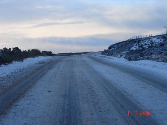
PHOTO
The A9 in Caithness - Colin Bird took this photo in 2006